

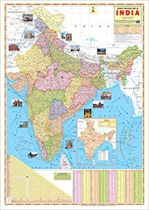
INDIA POLITICAL MAP WALL CHART Size 28×22 inch in Map Shows the Highest, Biggest, Largest, Smallest thing such Rivers, Mount, Seas, Boundaries Updated.
INDIA POLITICAL MAP WALL CHART Size 28×22 inch
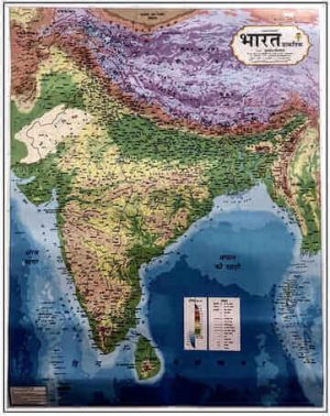
Map Chart Size 70 x 100 cm (28″ x 40″). Language : English. Certified By Survey of India. Multicolour offset printing. . Besides administrative boundaries the map also shows the Railway network, Golden Quadrilateral, East-West Corridor, North-South Corridor, National Highways & Major Roads, Rivers. India Map is easy to learn. The map covers both Physical as well as Political features of the country.Latest Map of India political with new Jammu and kashmir map approved by survey of india.

![Environment Wall Chart | in English [Laminated] [2 X 3 Feet]](https://pluspramesh.in/wp-content/uploads/2021/07/WhatsApp-Image-2023-10-28-at-11.49.13-AM-300x424.jpeg)
Geeta Rajora (Verified Customer) –
Devdatta De (Verified Customer) –
I didn’t recieve the indian political map plzz. Send my map
Rohit P. (Verified Customer) –
Beautiful clear representation along with a good quality print.
Rajni Rathore (Verified Customer) –
Steffiny Sumer (Verified Customer) –