

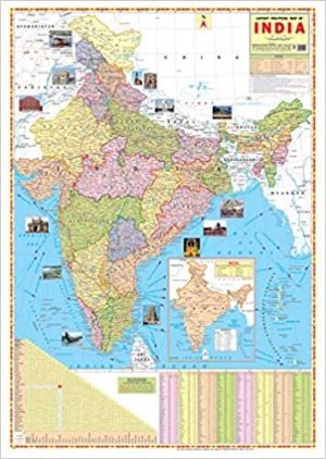
INDIA POLITICAL MAP WALL CHART Size 28×22 inch in Map Shows the Highest, Biggest, Largest, Smallest thing such Rivers, Mount, Seas, Boundaries Updated.
INDIA POLITICAL MAP WALL CHART Size 28×22 inch
Map Chart Size 70 x 100 cm (28″ x 40″). Language : English. Certified By Survey of India. Multicolour offset printing. . Besides administrative boundaries the map also shows the Railway network, Golden Quadrilateral, East-West Corridor, North-South Corridor, National Highways & Major Roads, Rivers. India Map is easy to learn. The map covers both Physical as well as Political features of the country.Latest Map of India political with new Jammu and kashmir map approved by survey of india.
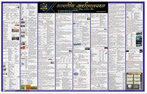
![Samvidhan Sanshodhan Wall Chart (Constitutional Amendment in India) [Laminated] [2 X 3 Feet]](https://pluspramesh.in/wp-content/uploads/2020/12/Samvidhan-Sanshodhan-Wall-Chart-Constitutional-Amendment-in-India-Laminated-2-X-3-Feet-300x191.jpg)
![Bharat Ka Samvidhan Wall Chart (Constitution of India) in Hindi [Laminated] [2 X 3 Feet]](https://pluspramesh.in/wp-content/uploads/2020/12/With-Model-Answers-7-300x300.jpg)
Ganesh Pawar (Verified Customer) –
need physical maps also…
Kirti (Verified Customer) –
Thank you so much. It took time to reach me but the parcel was absolutely rightly packaged. I was consistently being updated on texts about the delivery dates and about when it is supposed to reach me. The charts were packed nicely and not folded and cringed. Neat and as expected. However the April month ca magazine of vision ias I ordered was not up to the mark but I’m satisfied overall. The Mains test papers I ordered for were right. Thanks again. Look forward to order again if needed.
GYANENDRA PORWAL (Verified Customer) –
Sabari N (Verified Customer) –
Mange Ram (Verified Customer) –
Good product buy everyone