Cash On Delivery | Easy Return | 24x7 Call/whatsapp 07987211847

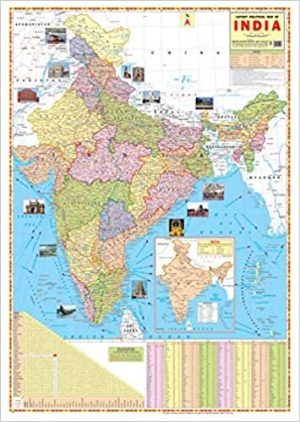
INDIA POLITICAL MAP WALL CHART Size 28×22 inch | English
Original price was: ₹100.00.₹90.00Current price is: ₹90.00.
Out of stock
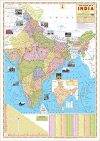
INDIA POLITICAL MAP WALL CHART Size 28×22 inch in Map Shows the Highest, Biggest, Largest, Smallest thing such Rivers, Mount, Seas, Boundaries Updated.
INDIA POLITICAL MAP WALL CHART Size 28×22 inch
Map Chart Size 70 x 100 cm (28″ x 40″). Language : English. Certified By Survey of India. Multicolour offset printing. . Besides administrative boundaries the map also shows the Railway network, Golden Quadrilateral, East-West Corridor, North-South Corridor, National Highways & Major Roads, Rivers. India Map is easy to learn. The map covers both Physical as well as Political features of the country.Latest Map of India political with new Jammu and kashmir map approved by survey of india.
30 reviews for INDIA POLITICAL MAP WALL CHART Size 28×22 inch | English
Only logged in customers who have purchased this product may leave a review.


![[MP GK Wall Chart] Madhya Pradesh General Knowledge Wall Chart in Hindi [MP GK Wall Chart] Madhya Pradesh General Knowledge Wall Chart in Hindi](https://pluspramesh.in/wp-content/uploads/2021/03/MP-GK-Wall-Chart-Madhya-Pradesh-General-Knowledge-Wall-Chart-in-Hindi-100x64.jpg)

![भारत का इतिहास Bharat ka Itihas Wall Chart [ Indian History Wall Chart in Hindi ] by Pramesh Jain and Prateek Jain](https://pluspramesh.in/wp-content/uploads/2020/11/भारत-का-इतिहास-100x141.png)
![Samvidhan Sanshodhan Wall Chart (Constitutional Amendment in India) [Laminated] [2 X 3 Feet] Samvidhan Sanshodhan Wall Chart (Constitutional Amendment in India) [Laminated] [2 X 3 Feet]](https://pluspramesh.in/wp-content/uploads/2020/12/Samvidhan-Sanshodhan-Wall-Chart-Constitutional-Amendment-in-India-Laminated-2-X-3-Feet-100x64.jpg)
![MP GK English [MP GK Wall Chart] Madhya Pradesh General Knowledge Wall Chart in english | MPPSC study material](https://pluspramesh.in/wp-content/uploads/2021/11/MP-GK-English-100x64.jpg)


![With Model Answers (7) Bharat Ka Samvidhan Wall Chart (Constitution of India) in Hindi [Laminated] [2 X 3 Feet]](https://pluspramesh.in/wp-content/uploads/2020/12/With-Model-Answers-7-100x100.jpg)

L Anar (Verified Customer) –
Clear and neat images ,mind-blowing packaging, very reliable and swift delivery. Will consider future purchase.
Achal T. (Verified Customer) –
Selvakumar J (Verified Customer) –
Asha G D (Verified Customer) –
Looks very nice..goood material..very informative
Adarsh HR (Verified Customer) –